
The Dictionary of Sydney was archived in 2021.
Sydney's Boundary Markers

Citation
Persistent URL for this entry
To cite this entry in text
To cite this entry in a Wikipedia footnote citation
To cite this entry as a Wikipedia External link
Sydney's earliest boundary markers
[media]There are few more lasting artefacts than the markers surveyors use to delineate the boundaries of land. In the early to mid nineteenth century, large carved stones were used to delineate the boundaries of Sydney Town while cast iron posts were used to mark the original wards of the City of Sydney.
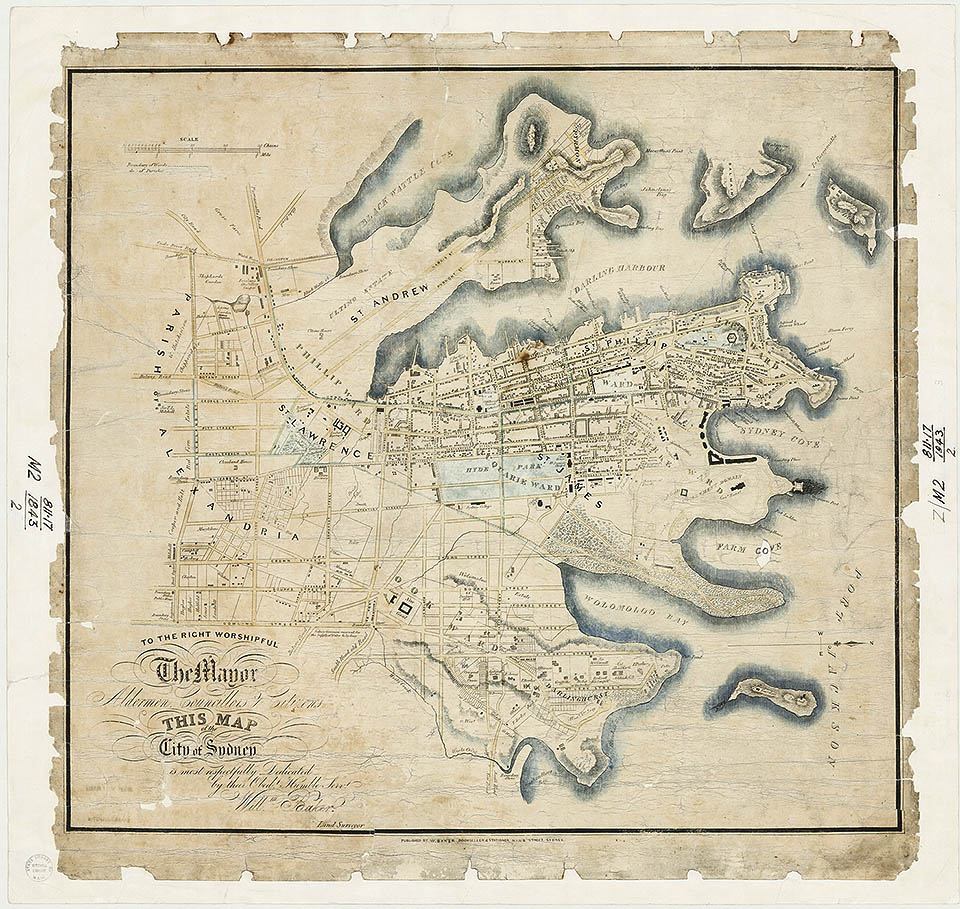
Mapping Sydney Town
[media]Major General Sir Richard Bourke arrived in Sydney in 1831 to become Governor and, in the following year, he commenced actions to have Sydney declared a town. At that time, Sydney lay to the south of Port Jackson, between Blackwattle Bay and Rushcutters Bay, so the northern boundary was the shoreline with a total distance of about 18 kilometres (11 miles). His western, southern and eastern boundaries are marked on maps by Baker [1] & Wells [2] and were essentially straight lines making up a distance of 5.6 kilometres (3.5 miles) – the southern boundary being the present day Cleveland Street. Bourke had stones installed at the corners of these town boundaries, only eight being needed. On Baker's map, the position of the boundary stones is labelled with an open circle. The stones are more clearly shown by MacDonald [3] even though, in 1930, he was only able to find three of them.
Boundary stones
For clarity, the eight boundary stones are here numbered in an anti-clockwise sequence.
1. Ultimo
The first boundary stone was located at the south-west corner of the intersection of Wattle Street and McArthur Street, Ultimo, a location then on the eastern bank of Black Wattle Creek where it entered the harbour. McDonald reported a verbal description of it being: 'about five feet by two and a half feet square' [4] (152 centimetres by 76 centimetres square) which computes to an improbably large mass of about 2.04 tons (2,070 kilograms).
2. Glebe
[media]Originally installed on the north-east corner of the intersection of Bay Street and Broadway, Ultimo, and after being moved at least three times, the second boundary stone is now (2012) located in Jubilee Fountain Square on the north-west corner of the junction of Parramatta Road with Glebe Point Road, Glebe. Only a slice of the original marker stone has been retained and it is mounted in a 35 centimetre thick basalt wall, back-to-back with a memorial stone to the Indigenous boxer Dave Sands.
3. Darlington
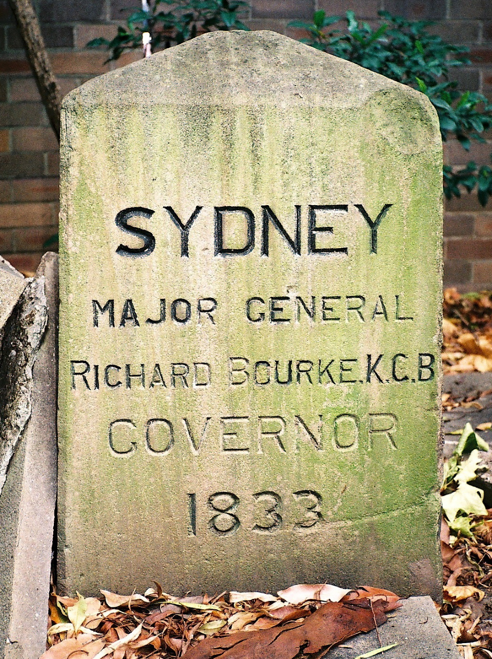
Originally [media]installed near City Road, on the south-west corner of the intersection of Cleveland Street with Cooks River Road (which became Darlington Road) [5], the third boundary stone has been moved twice and is now located on the grounds of the University of Sydney in the north-north-west corner of the garden of International House, Darlington, to which there is restricted access. In 2011, it was deeply buried with only 80 centimetres exposed and, based on the dimensions that could be measured, it weighs at least 8.5 hundredweight (430 kilograms).
4. Redfern
The fourth boundary stone was located near the intersection of Cleveland Street with George Street, Redfern, in a position that equates to the location of Renwick Street.
5. Redfern
The fifth boundary stone was located on the south-west corner of the intersection of Cleveland and Elizabeth streets, Redfern.
6. Moore Park
Originally installed [media]on the south-west corner of the intersection of Cleveland Street with South Dowling Street (as now named), Redfern, the sixth boundary stone has been moved many times and is now located in the north-west corner of Moore Park South, on the east side of Southern Cross Drive. It is in poor condition but, based on the exposed dimensions, it must weigh at least 12 hundredweight (about 600 kilograms).
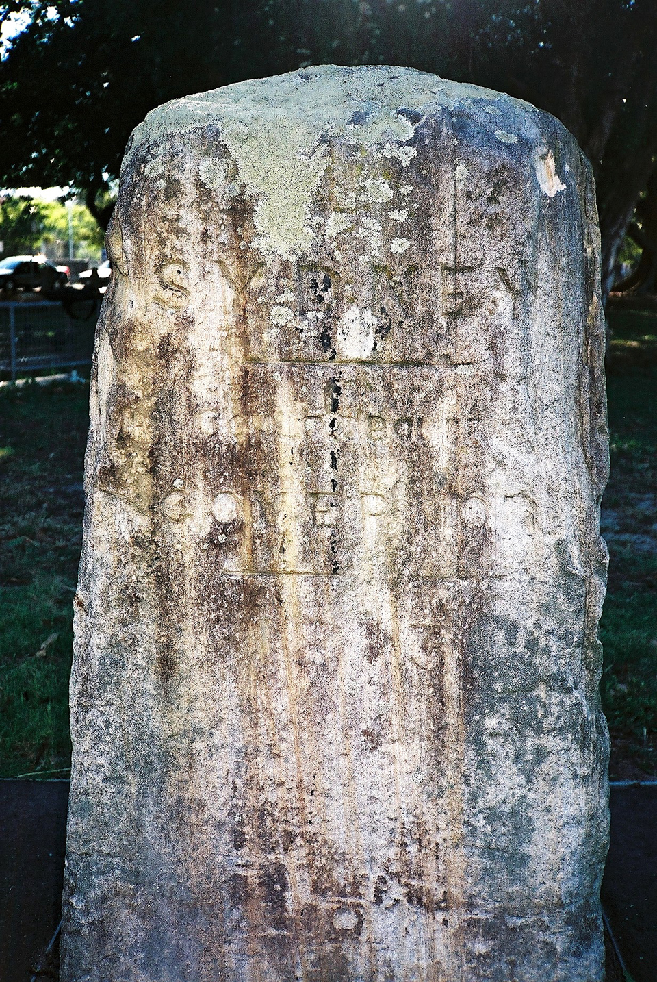
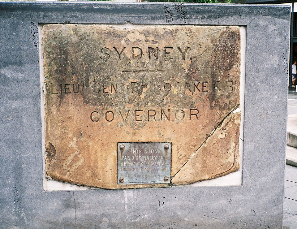
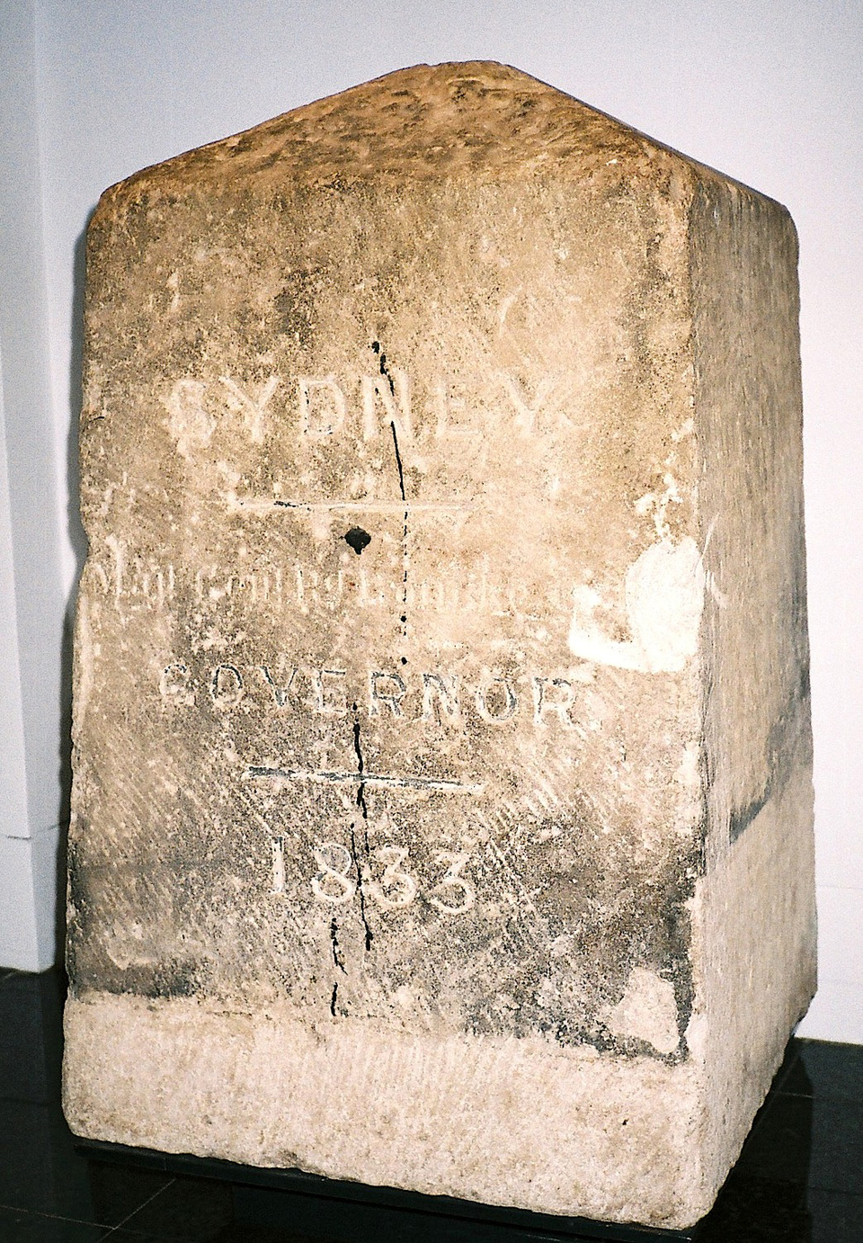
Originally installed on [media]the south-west corner of the intersection of Oxford Street with South Dowling Street (as now named), Surry Hills [6], and after several moves, the seventh boundary stone is now displayed in the Museum of Sydney. It is in excellent condition and, being fully exposed, the mass can be estimated with confidence as 11 hundredweight (about 550 kilograms).
Most probably originally installed to the north of New South Head Road, the eighth boundary stone was located on the eastern bank of a sharp bend in Wests Creek, at the foot of a slope between the eastern ends of Queens Avenue and Clement Street, Rushcutters Bay.
Where are they now?
In 2011, the whereabouts of half of the original boundary stones was established but all had been moved from their original locations. The seventh boundary stone is now safely preserved in the Museum of Sydney and the third is off the street on private property, so it is also protected. The first, fourth, fifth and eight stones have not been seen since the nineteenth century and what happened to them is a mystery.
Boundary posts
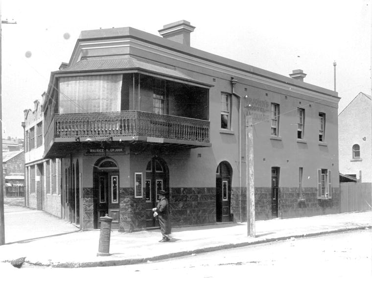
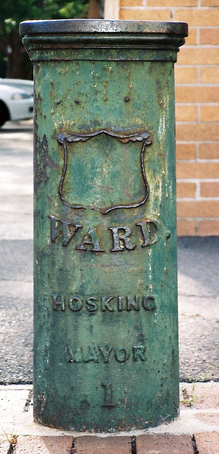
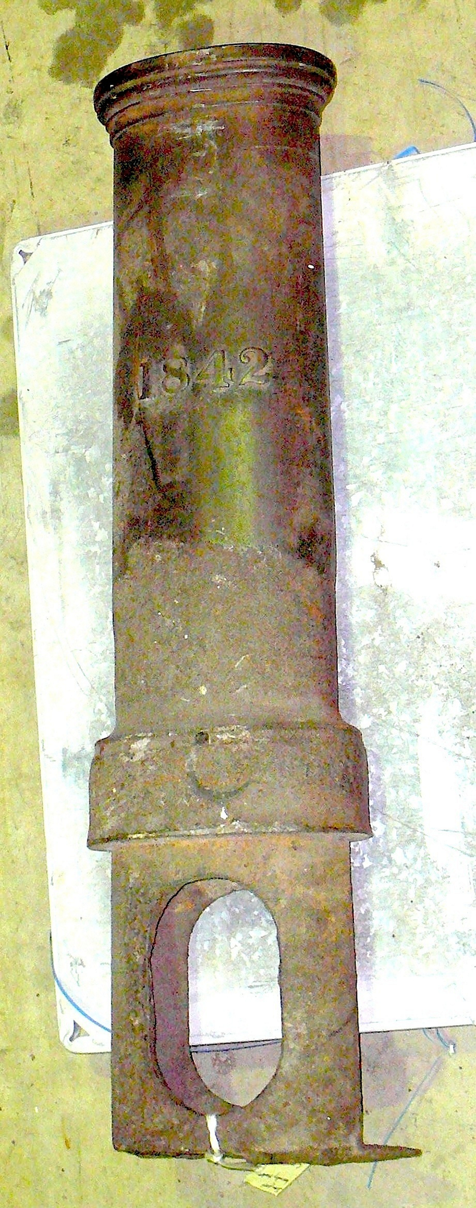
[media]Less than a decade after the Sydney Town boundary stones were installed, Governor Gipps proclaimed Sydney to be a city [7] and had an unknown number of cast iron boundary posts erected to mark the corners and bends of the boundaries of the wards as defined in 1842. These boundary posts were made by the firm of PN Russell [8] from cast iron and reputedly weighed about 266 pounds (120 kilograms) [9]. All were embossed on the rear side with the date of the incorporation of the City of Sydney – 1842 – and on the front with an empty shield with the ward name above and below the words 'WARD', 'Hosking' and 'Mayor', plus a unique identity number (how those numbers were actually allocated is not known).

Where are they now?
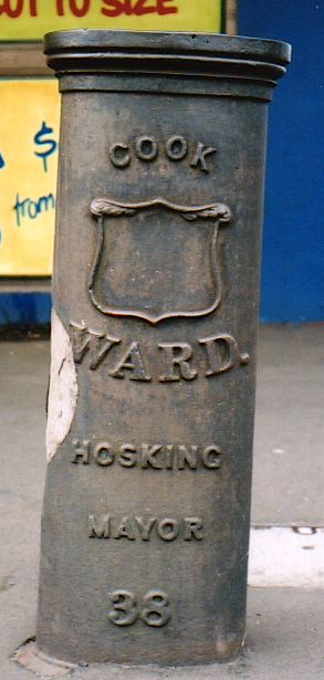
In 2011, only four boundary posts were traced and only three remain on streets. [media]One of these three is still in its original location on the north-west corner of the intersection of Cleveland Street and South Dowling Street.
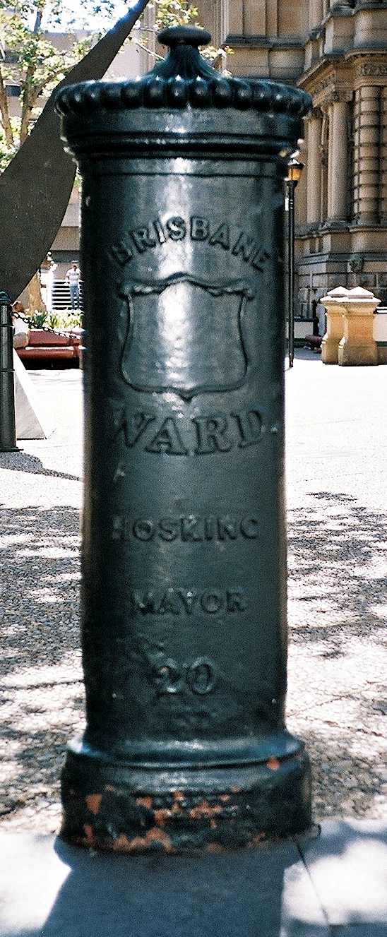
[media]The most complete boundary post is at Town Hall Square, on the south-east side of the Town Hall steps – not its original location, which is unknown. This post has both an ornamental cap and a plinth with the manufacturer's name embossed on the front, although that lettering is now essentially illegible.
[media]For at least five decades, there has been a boundary post located at south-east corner of the junction of Bourke Street and Plunkett Place, Woolloomooloo, however, that location was not on a ward boundary until the revision of the dividing line between the Bourke and Fitzroy Wards in 1870, hence this post was not one of the original set.
[media]By far the best preserved boundary post is that at the Powerhouse Museum collection stores at Castle Hill. It is the only one that can be completely measured and its total length is 145 centimetres. The buried base is now empty but would have contained soil when the post was in situ and the rest was filled with concrete at an unknown date. Where it was installed is not known.
Notes
[1] William Baker, A Map of the City of Sydney Respectfully Dedicated to the Citizens of the Capital of New South Wales by their Obedt. Humble Servts, Engraver & Lithographer, King St. East., 1842, Mitchell Library map collection, State Library of New South Wales, Z M2 811.17/1842/1; William Baker, To the Right Worshipful the Mayor, Aldermen, Councillors & Citizens, This Map of the City of Sydney is Most Respectfully Dedicated by Their Obedt. Humble Servt. Willm. Baker, Land Surveyor, W Baker, Bookseller & Stationer, King Street, Sydney, 1843, Mitchell Library map collection, State Library of New South Wales, Z M2 811.17/1843/2
[2] WH Wells, To the Mayor, Aldermen, Councillors & Citizens This Map of the City of Sydney /Is Most Respectfully Dedicated by Their Obed. & Humble Servt. Willm. Henry Wells, Candidate for the Office of City Surveyor, Sydney, 1842, Mitchell Library map collection, State Library of New South Wales, Z M2 811.17/1842/1; WH Wells, To the Right Worshipful the Mayor, Aldermen, Councillors & Citizens This Map of the City of Sydney is Most Respectfully Dedicated by Their Obed.t Humble Serv.t Will.m Henry Wells, Land Surveyor / Carmichael Sc., James Tegg, Bookseller & Stationer, George Street, Sydney, 1843, Mitchell Library map collection, State Library of New South Wales, Z M2 811.17/1843/1; Shirley Fitzgerald, Sydney 1842–1992, Hale & Iremonger, City of Sydney, 1992
[3] Plan between pp 96–97 in WA MacDonald, 'The Boundary Stones of Sydney', Journal and Proceedings of the Royal Australian Historical Society, vol 16, no 2, 1930, pp 81–102
[4] WA MacDonald, 'The Boundary Stones of Sydney', Journal and Proceedings of the Royal Australian Historical Society, vol 16, no 2, 1930, p 85
[5] WA MacDonald, 'The Boundary Stones of Sydney', Journal and Proceedings of the Royal Australian Historical Society, vol 16, no 2, 1930
[6] WA MacDonald, 'The Boundary Stones of Sydney', Journal and Proceedings of the Royal Australian Historical Society, vol 16, no 2, 1930
[7] Govenor Gipps, 'An Act to Declare the Town of Sydney to be a City, and to Incorporate the Inhabitants thereof, 3 August 1842, Anno Sexto Victoriae Reginae No. 3 Date 1842', New South Wales Government Gazette, vol 2, 3 August, 1842, pp 1105–1127; Govenor Gipps, 'An Act to Declare the Town of Sydney to be a City, and to Incorporate the Inhabitants thereof, Anno Sexto Victoriae Reginae No. 3. Date 1843', New South Wales Government Gazette, vol 2, 3 August 1842
[8] City Engineer, report dated 20 July 1926, City of Sydney Archives, 12/018, 47122, Minutes of the Works Committee 1, 22 Dec 1898–04 Jan 1982 (2 Jan 1925 to 1 Dec 1926, p 567, 2220/26); Photograph opposite page 40 in CH Bertie, The Early History of the Sydney Municipal Council, With an Account of the Town Halls, 1911, a paper read before the Australian Historical Society on the 23rd day of August 1910, Sydney, 1911, Mitchell Library manuscript collection, State Library of New South Wales, Q352.0911/5B1
[9] Controller of Assets and Stores, Minute Paper, 3 April 1917, Town Clerk's Department Correspondence Folders 01 Jan 1914–31 Dec 1978, City of Sydney Archives, 1118/17, 32023
.